MARCH 25, 2012 — “You can get whatever snacks you want,” I tell my nephew, Luke, as we walk into a grocery store. I’m about to take him on his first hiking and camping trip. “One of the best things about hiking is that you can eat anything you want!”
“Gummy penguins?” he asks timidly, reaching for two bags on the shelf. It’s obvious that his parents don’t usually let him eat gummy penguins.
“Whatever you want!” I say. I treat him like an adult, because I don’t really know what else I’m supposed to do.
When we arrive at our campsite near Big Bear Lake in Southern California, Luke is enthralled by my ultra-light backpacking tent, which I teach him to construct in less than two minutes. Luke rushes impatiently through our classic camping dinner of hot dogs and s’mores, because he can’t wait to get back inside the tent. After the sun sets, we crawl inside, and Luke produces a bag of board games that he’s brought. I chuckle, because playing board games is my favorite part of backpacking trips too. While we nibble on gummy penguins and move wooden pirates onto sailboats, I realize that Luke may not be the only eight-year-old on this camping trip.
On another backpacking trip, in January, five friends and I spent hours playing the party game Time’s Up (a boxed version of Celebrity) during a three-day journey on the California Riding and Hiking Trail (CRHT) in Joshua Tree National Park. My friends Brad and Julie had never been on an overnight backpacking trip before, so we decided on the 37-mile CRHT, which is almost totally flat, easy to follow, and warm enough for day hiking, even during winter. At night, however, even with the comfort of a campfire and board games, Brad and Julie found themselves shivering from the cold winter temperatures, even in their sleeping bags. Though I had warned them about frigid desert nights and sent them a gear list, I had failed to order them to bring fluffy down jackets, naively wanting to avoid paternalism and nagging. When I woke the next morning to a thermometer reading 20°F degrees and campers reluctant to leave their sleeping bags, I feared that Julie and Brad wouldn’t voluntarily join a backpacking trip ever again.

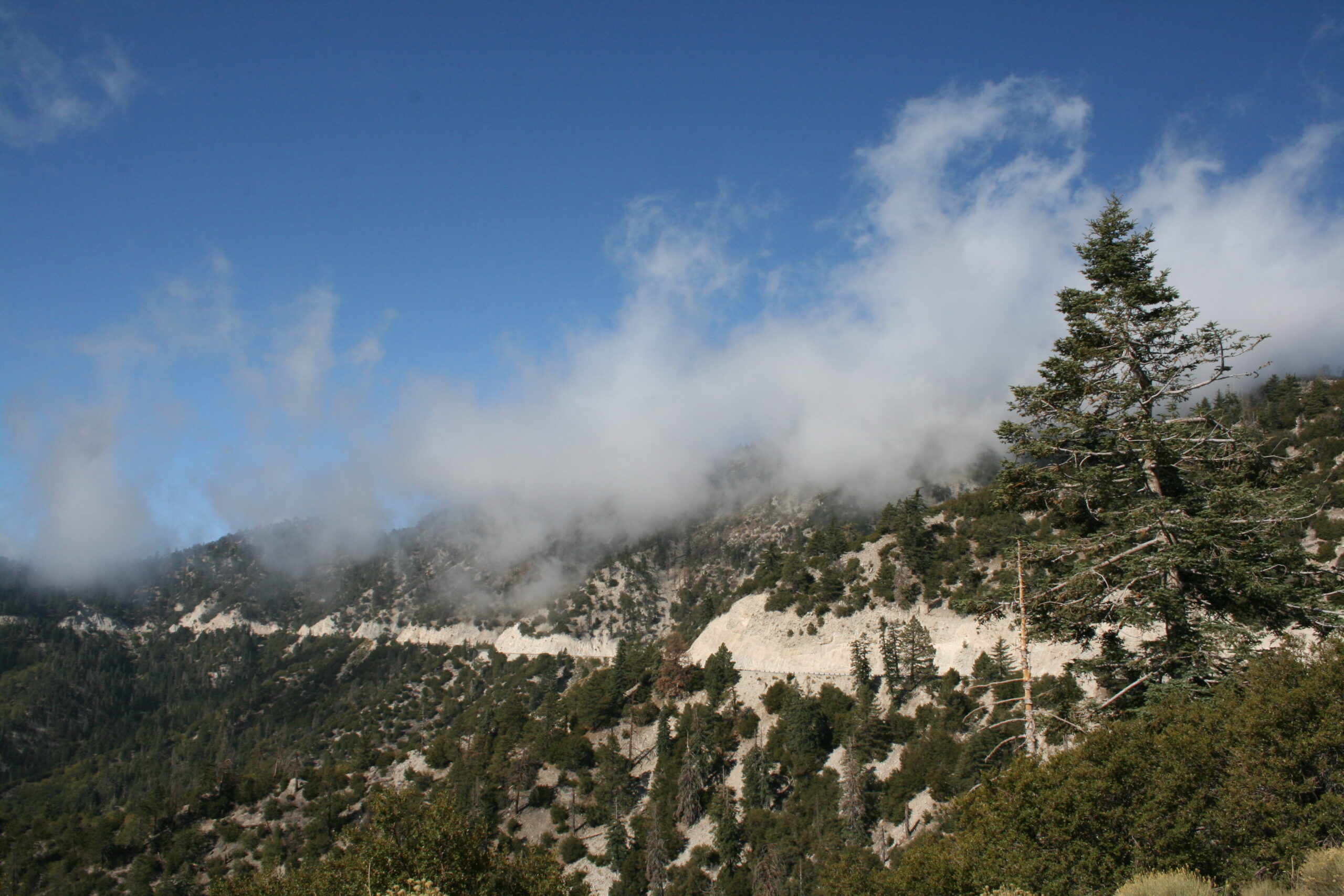
Clouds hover over the winding road to Big Bear Lake, California.
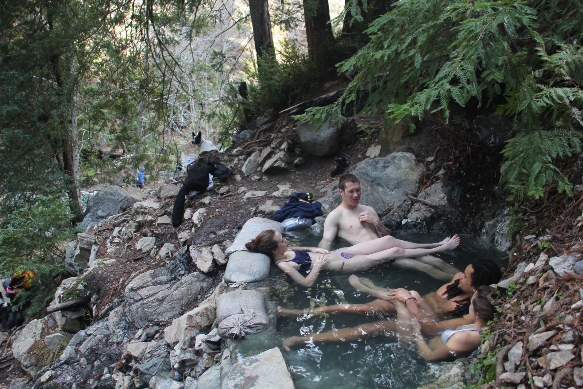
A few weeks later, Wendy, Rich and I took my friend Rose on her first backpacking trip to Sykes Hot Springs in Big Sur, California. The trail, one of the most popular in California because of the sauna-like swimming pools at the end, was infested with first-timers carrying badly-fitted and over-weighted packs. Though I gave Rose lots of guidance about how to pack and handle her backpack, her biggest concern ended up being about going to the bathroom in the wilderness. After lunch on our first day, she announced to the group that she needed to excuse herself, taking some toilet paper and hand sanitizer with her. I didn’t think much about giving her advice. Fifteen minutes later, she returned, looking uncomfortable.
“I, uh, couldn’t do it,” she said. Wendy, Rich, and I tried to suppress our laughter. Not accustomed to counseling adults on how to go to the bathroom, I looked to Wendy, who coached Rose to find a very private spot behind a tree and relax. After another 15 minutes, Rose returned.
“I was successful!” she said. But she looked traumatized, as though she had already decided that she would never venture more than 10 feet from a toilet ever again. I felt like the experience was my fault, and I realized that my teaching skills — both for children and adults — needed some honing.

Couples relax in one of the Sykes Hot Springs in Big Sur, California.
On the second day of my camping trip with my nephew, Luke, I offer to make eggs for breakfast, but he’s not interested.
“I want gummy penguins,” he says.
“Fine with me,” I say. After all, someone who wants to eat gummy penguins for breakfast is someone I understand — and every penguin’s tummy is filled with a gooey, tart liquid! While packing up our camp, we manage to eat almost two entire bags of the penguins.
“Time to go hiking!” I say excitedly, trying to pique Luke’s interest. I’ve planned a very easy, one-mile hike for Luke’s first hike, but his face starts looking pale as I drive my car up the windy mountain road toward the trailhead.
“I don’t feel good,” he mumbles. “I get motion sick.” Your good parents also probably don’t usually let you eat an entire bag of gummy penguins for breakfast, I think. But, as soon as the car stops moving at the trailhead, Luke starts looking healthier.
“Okay, get your backpack, and put on pants instead of those shorts,” I say. “It’s cold out.”
“But I want to wear shorts!” he retorts.
“Fine with me,” I say, because, well, that’s what I would say to an adult.
We’ve hiked about a half-mile (ten minutes), and he seems to be having fun climbing on rocks near the trail, when suddenly, Luke announces: “I don’t like hiking. Can we turn around?”
“Luke, this hike is a loop. We can turn around, but it will take just as long to go back as it will to go forward,” I explain.
“I don’t like hiking!” he whines. Then, he starts crying.
I try to reason with him like I would with an adult, but it occurs to me that I’m wasting my time. He doesn’t actually dislike hiking. He dislikes feeling sick and cold. Yet, here I am, dragging an eight-year-old child, with a stomach filled to the brim with high-fructose corn syrup and wearing shorts, through a 40°F forest.
We return as quickly as possible to the car. Immediately, Luke, seems happy again.
“Can I have more gummy penguins?” he asks, as our car snakes back down the mountain. This time, I’ve learned my lesson.
“No more,” I respond. He doesn’t complain.
How to Hike Joshua Tree’s California Riding and Hiking Trail
OVERVIEW: Joshua Tree’s California Riding and Hiking Trail is an easy 37-mile, one-way traverse starting at Black Rock Campground and ending near the North Entrance Station. The entire trip can be completed in three days because the trail is so flat and well-maintained, though the trip can be extended to four days. If you decide to spend four days on the trail, you can add the summit of Quail Mountain, Joshua Tree’s highest point, to your itinerary.
DIRECTIONS: Joshua Tree National Park is a 2.5-hour drive from Los Angeles. From Los Angeles, take I-10 East to CA-62 North (Twentynine Palms Highway). Then, to get to Black Rock Campground, turn right from Twentynine Palms Highway onto Joshua Lane, and follow it until it dead-ends into San Marino Drive. Turn right, then turn left onto Campground Road. A backcountry information board stands at the California Riding and Hiking Trail trailhead.
LOGISTICS: Cars can be parked at the Park’s designated backcountry boards, but you’ll want to cache a second car at the end of the trail if you’re hiking in only one direction. Remember, no water is available in Joshua Tree. Hikers must carry all of the water they’ll need for the entire trip or they must cache water in advance.
ROUTE: The simplest three-day itinerary for the California Riding and Hiking Trail is as follows. The distances while carrying backpacks may seem long, but the flat and easy trail makes for a relaxed trip. Water can be cached in advance at the car-accessible backcountry boards on Keys View Road and Geology Tour Road.
Day 1: Black Rock Campground to backcountry camping in Juniper Flats, near Keys View Road (12 miles)
Day 2: Juniper Flats to backcountry camping near Geology Tour Road (12 miles)
Day 3: Geology Tour Road to the North Entrance Station (12 miles)
However, keep in mind that backcountry fires are prohibited in the Park. Because we did this hike in the winter, we decided to stay overnight at campgrounds so that we could build campfires. In addition, we wanted to summit Quail Mountain, Joshua Tree’s highest point. The following campground itinerary has the added benefit of allowing hikers to cache both water and camping equipment at the car-accessible campgrounds before the hike. But, keep in mind that driving from Black Rock Campground and Upper Covington Flat to Belle Campground takes about an hour (one way).Day 1: Upper Covington Flat to Quail Mountain summit to Ryan Campground (16.3 miles)
Day 2: Ryan Campground to Belle Campground (12.6 miles)
Day 3: Belle Campground to North Entrance Station (6.2 miles)
Hikers can easily add another day at the beginning of this itinerary, hiking from Black Rock Campground to Upper Covington Flat, to complete the entire trail in four days. View the route below or download the Without Baggage Joshua Tree California Riding and Hiking Trail GPS track in GPX or KML format.How to Hike to Sykes Hot Springs in Big Sur, California
OVERVIEW: The trip to Sykes Hot Springs in California’s Ventana Wilderness is a 21.6-mile, two-day, round-trip hike. Though Sykes is a very popular California backpacking trip, it is not easy, even for fit hikers: the trail’s relentless, rolling hills require backpackers’ knees to endure a 5,502 total elevation gain (and loss).
DIRECTIONS: The trailhead for Pine Ridge Trail, which leads to Sykes Hot Springs, begins at Big Sur Station, a five-hour drive from Los Angeles or a three-hour drive from San Francisco. From Los Angeles, take US-101 North to San Luis Obispo, then take Pacific Coast Highway North (CA-1/Cabrillo Highway) to Big Sur Station, just north of the northern boundary of Julia Pfeiffer Burns State Park. From San Francisco, take US-101 South to San Juan Bautista, where US-101 merges with CA-156 West. Then, merge onto Pacific Coast Highway South (CA-1/Cabrillo Highway) in Castroville and proceed along the coast to Big Sur Station, just south of the southern boundary of Andrew Molera State Park.
LOGISTICS: A parking lot at the trailhead accommodates cars for $5 per day. Water sources are abundant along the trail, but be sure to take a water filter.
ROUTE: Pine Ridge Trail is easy to follow to the Big Sur River. Upon arriving at the River, the Hot Springs can be found by turning left and hiking about a half-mile down river. The Hot Springs are high on the river bank to your left. Campsites abound along the river in either direction, so don’t be discouraged if crowds have already taken the obvious ones. View the route below or download the Without Baggage Sykes Hot Springs GPS track in GPX or KML format.
Hi. I randomly came across this post and enjoyed it, thoroughly. 1. I chuckled at the kid parts mostly, because I have two of my own and can relate. 2. I can also relate to the burrito part in your bio. Burritos are good. Nice site.
REALLY well-written article that encapsulated the first-timer experience perfectly…from both sides of the fence. Great job.
You're a great writer Hank! I'm looking to plan my first trek and your site is perfectly balanced between entertaining and informative. Thanks for your help!